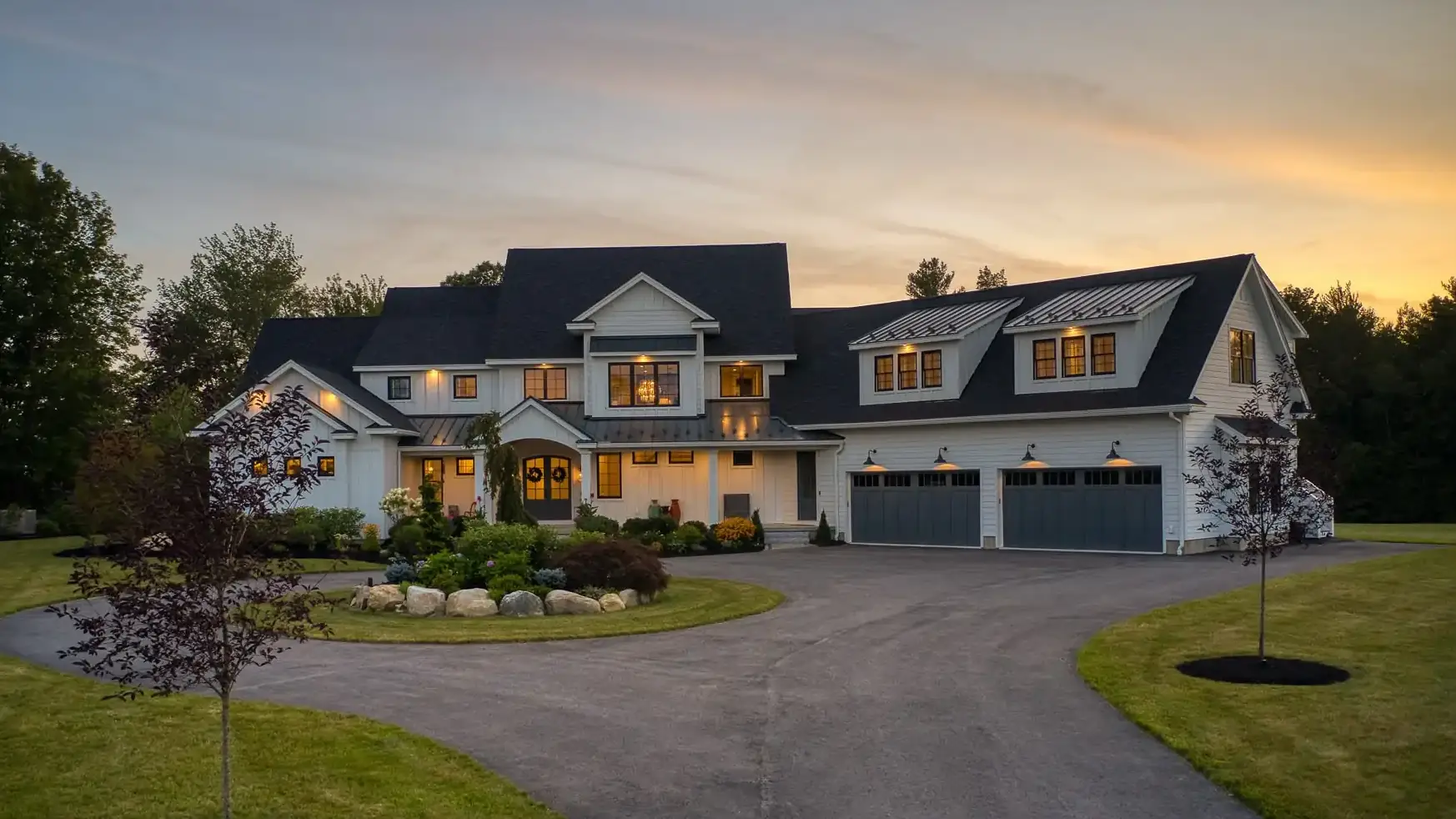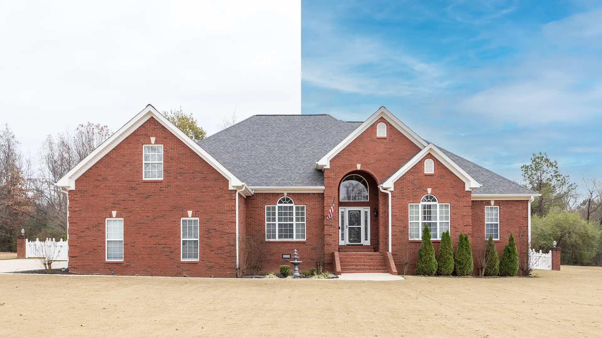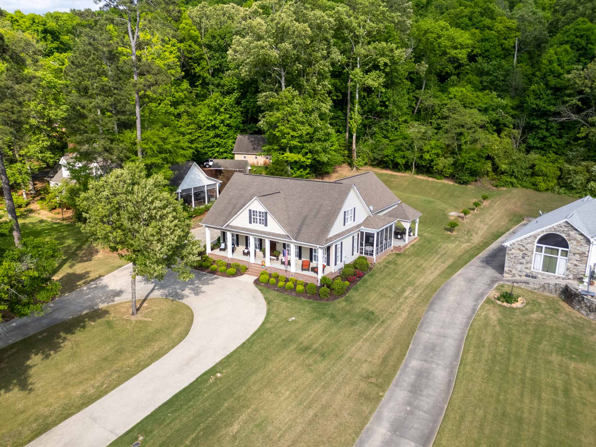
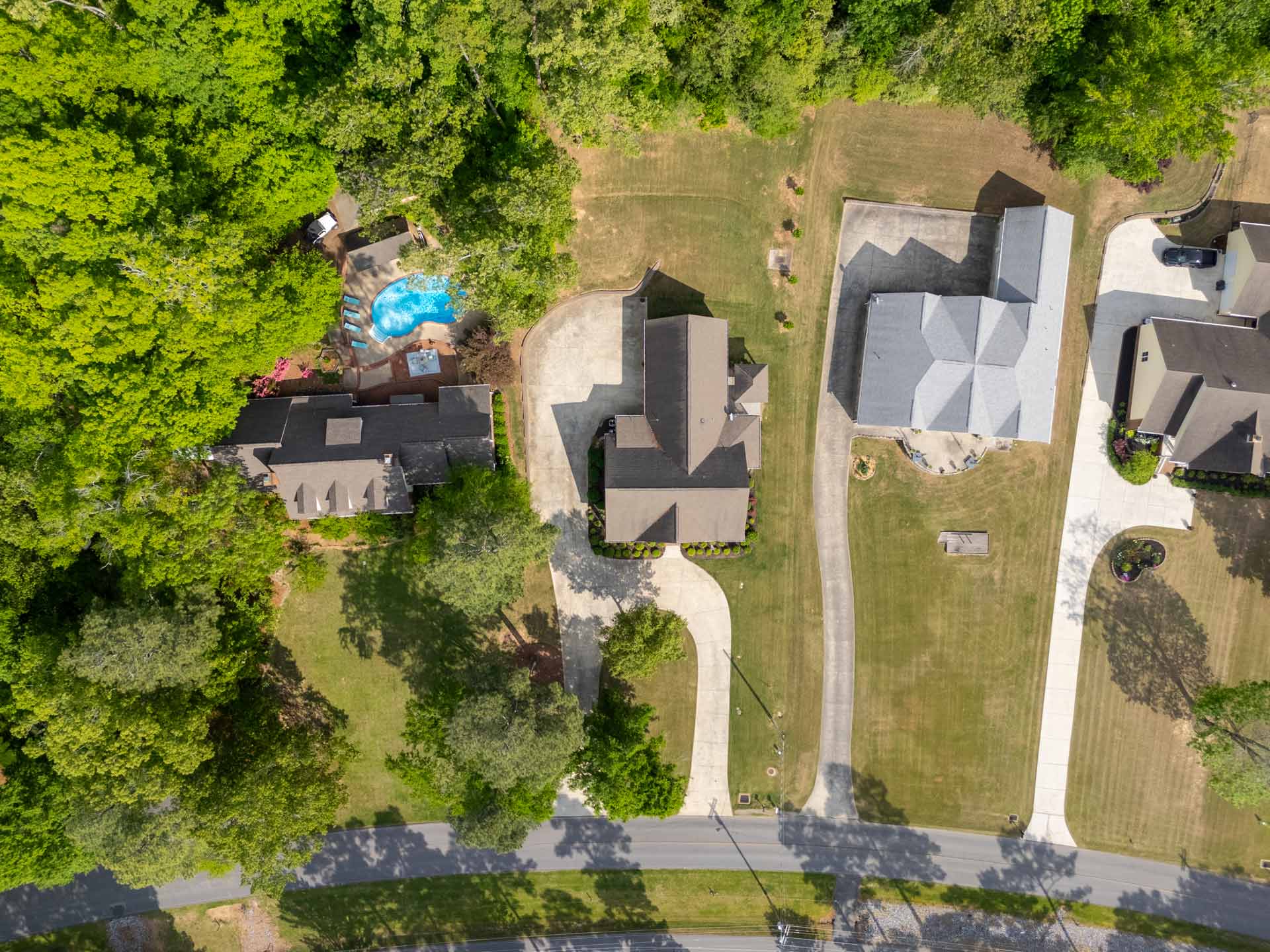
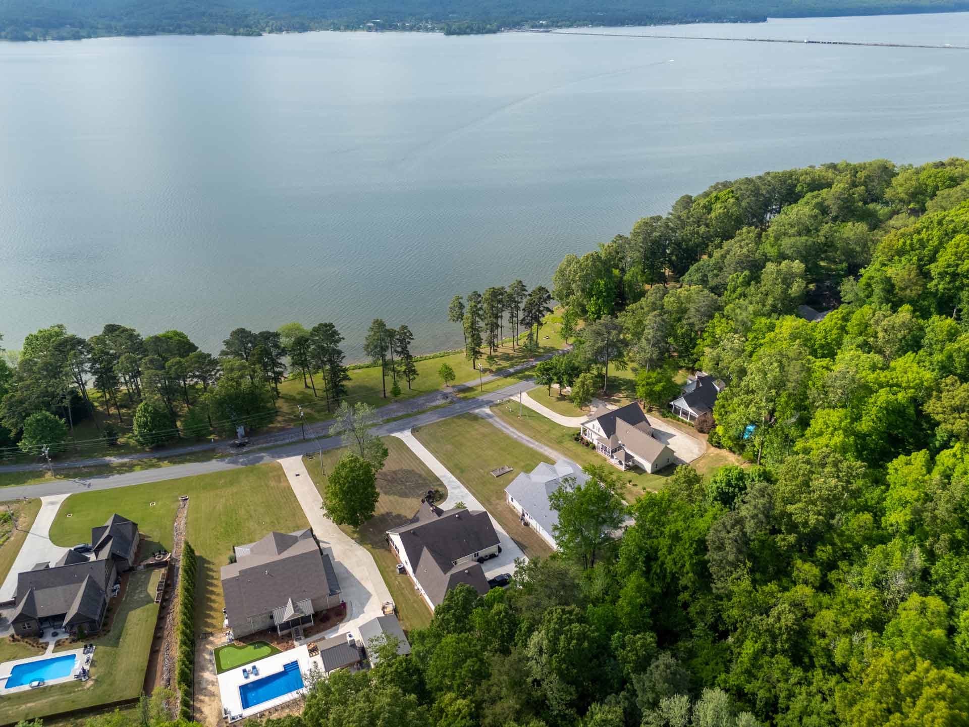
Aerial photography reveals what ground-level shots can’t — property scale, lot layout, surrounding landscape, and neighborhood context. It’s the perfect way to spotlight large lots, scenic views, outdoor features, or proximity to key amenities.
Our FAA-certified drone operator captures high-resolution exterior photos from multiple angles to help buyers understand not just the home — but where it sits and what makes it special.
Includes a backup date for weather delays. Note: Some locations may require FAA airspace approval, which could shift the shoot date.
Delivered next-day, ready for MLS, marketing materials, and social platforms.
of Sellers see Faster House Sales with Aerial Photography
of Buyers are More Likely to Schedule an In-Person Showing with Aerial Photos
of Sellers Prefer Agents Using Drone Photography
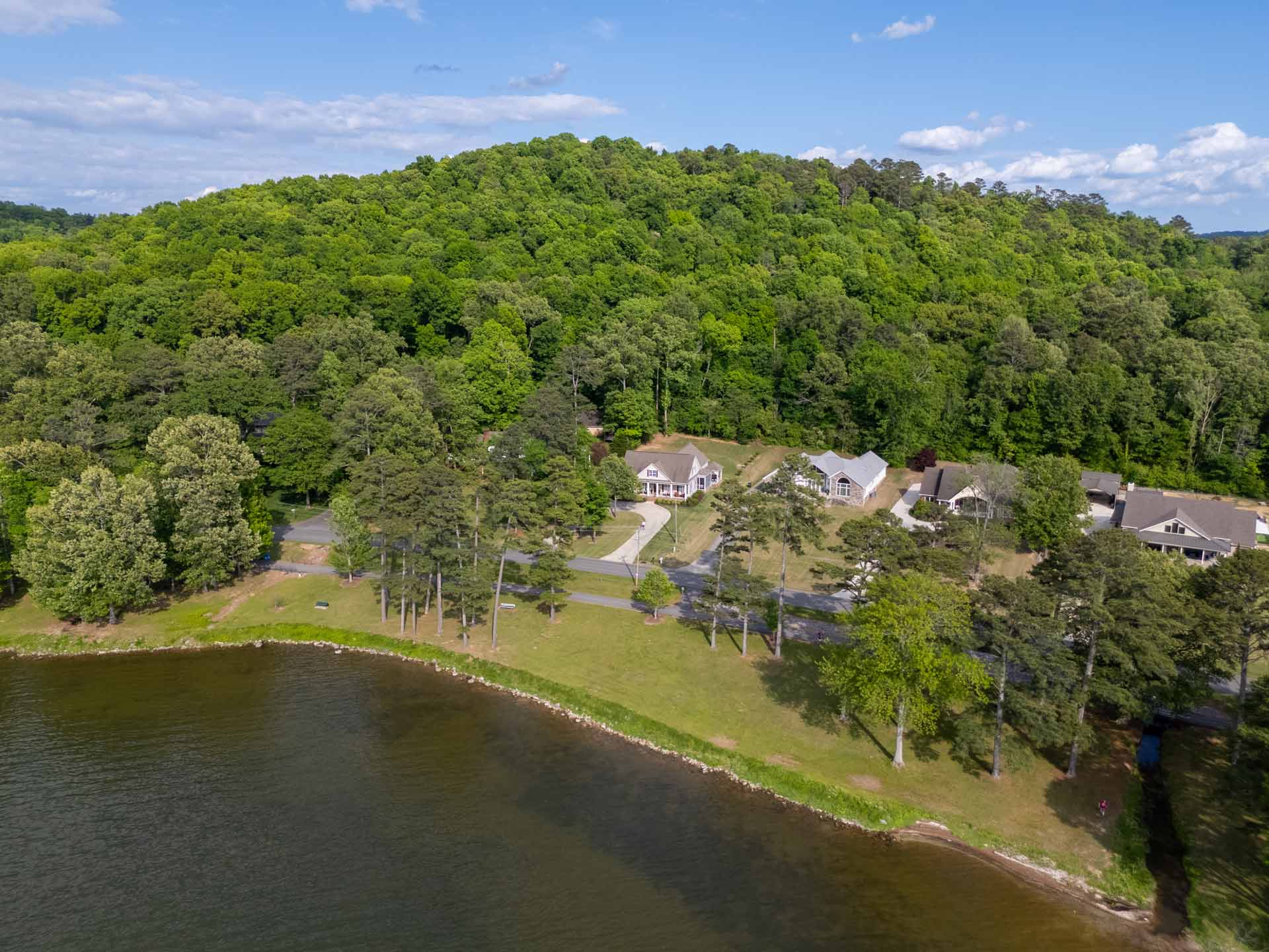
It’s professional aerial imaging captured by a licensed drone operator to show a property and its surroundings from above — highlighting the lot, landscape, outdoor features, and neighborhood context.
Ground photos show rooms and exterior angles from eye level. Drone photography reveals the full property layout and unique perspectives that buyers can’t get with standard shots.
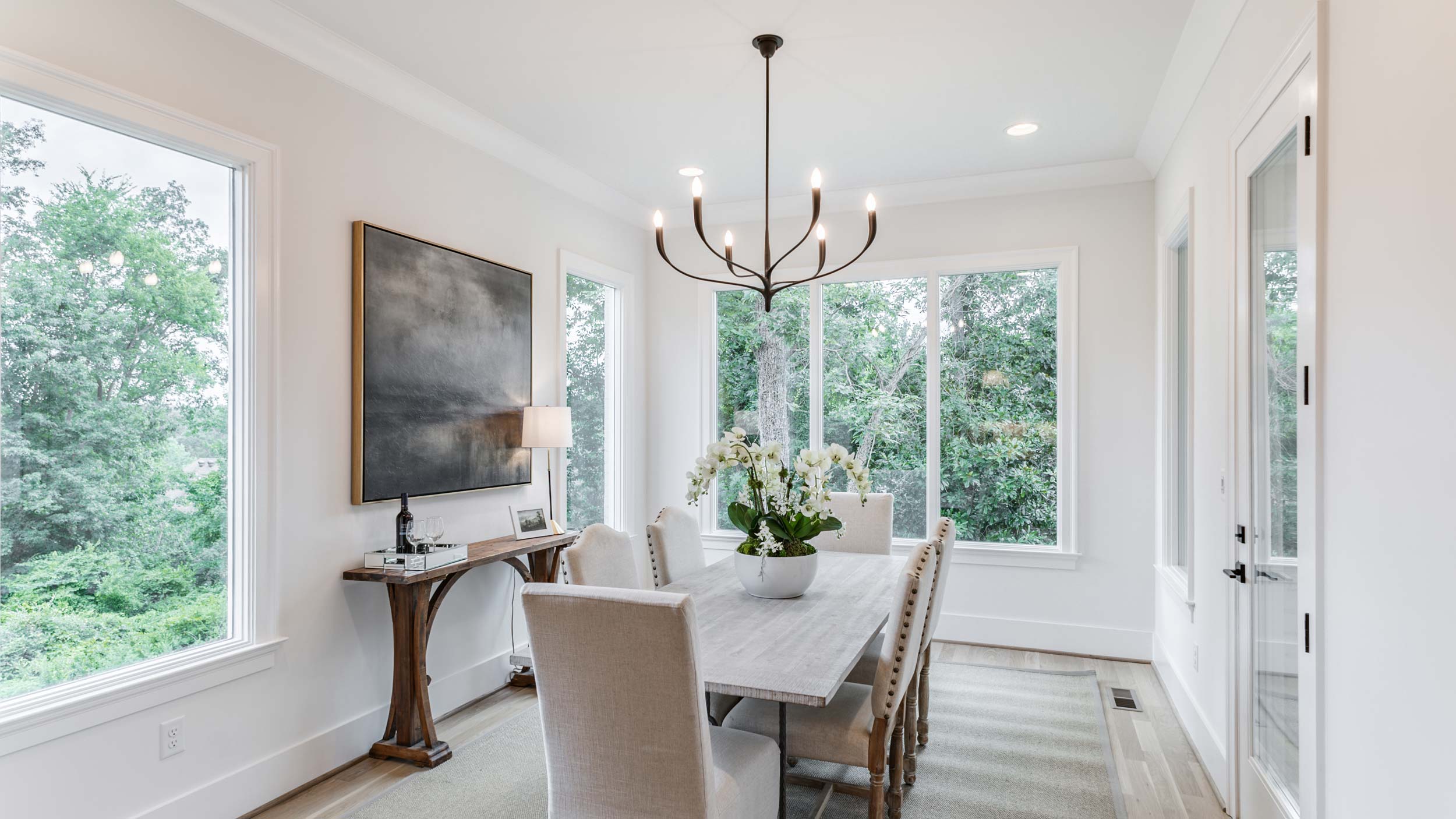
Drone photography is especially impactful for larger lots, waterfront properties, estates, scenic views, and homes with outdoor amenities you want to highlight.
All edited aerial photos are delivered by the end of the day after your shoot — same next‑day turnaround as our other services.
A backup date is included for weather delays, but in some areas FAA airspace approval may be required, which can push the shoot day back.
Yes — aerial images are yours to use on MLS, websites, social media, print, and all other marketing channels.